Since 2015, Cornell University researchers have learned details of very weak earthquakes that occur in Tompkins County, NY, and about more distant earthquakes whose waves reach the Finger Lakes area. A report on seismic activity is to be posted each week during summer 2022.
If you’d like to learn about earthquakes, read on!
What is an earthquake?
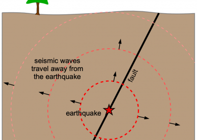
An earthquake happens when rock below ground moves suddenly. Most commonly, this happens when one rock slips past another rock along a pre-existing broken surface a fault surface. The amount of slip may be a small fraction of an inch or several yards. Less frequently, an earthquake happens because the rock broke. Even though an earthquake happens below ground, we feel the earthquake at the earths surface because the sudden movement makes a seismic wave, which travels away from where the rock slipped.
The seismic waves move away from the earthquake much like ripples on the surface of water move away from a rock dropped into a pond. As the waves travel farther and farther from the earthquake (or the dropped rock), they become smaller and smaller.

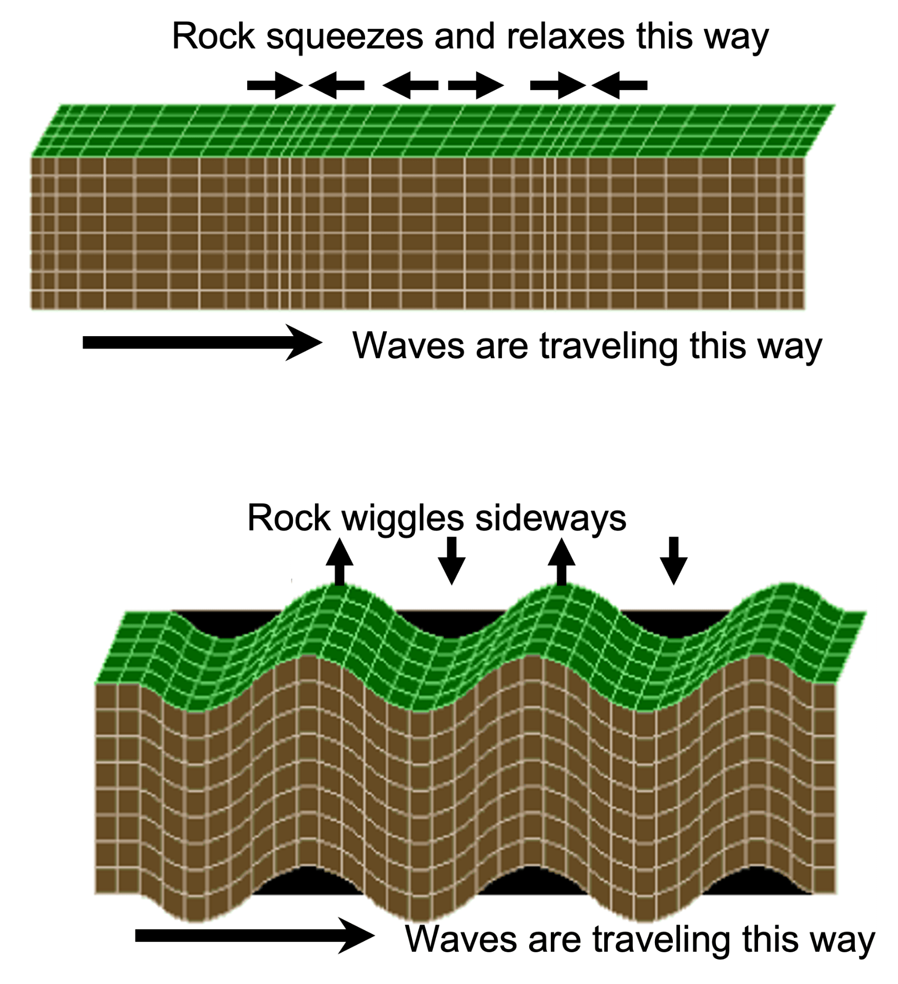
Two types of seismic waves travel through solid rock. For one kind, the material moves back and forth (squeezing and relaxing). This is the same as a sound wave. For the second kind, the material wiggles sideways, back and forth. Only the first type, squeezing and relaxing, can travel in a liquid or the air.
Not all seismic waves are produced by earthquakes. Other things that can cause shaking at the Earth’s surface include explosions that are directed into the ground such as for mining or testing of bombs, and also sudden shifts in materials on the surface of the earth, such as snow avalanches, rocks falls, and floods caused by sudden failure of a dam. These are referred to as seismic events.
Earthquake locations and distribution around Earth
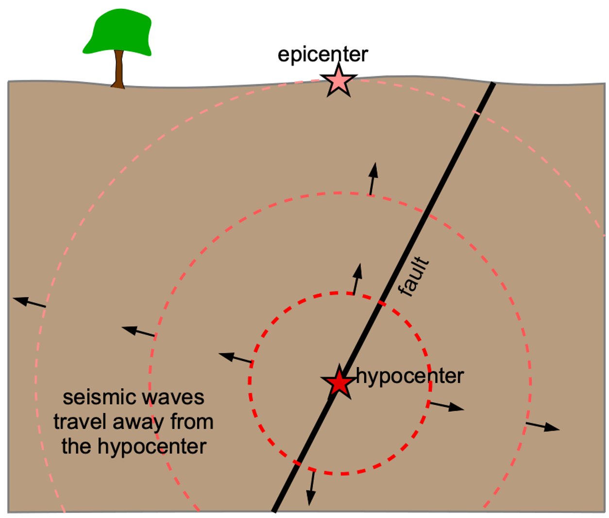
An earthquake occurs at a particular position inside the earth. We call the position on the Earth’s surface directly above the place the rock broke or shifted the “epicenter” of the earthquake, and the position below ground the “hypocenter.” The U.S. Geological Survey reports both the location of the earthquake (epicenter) and, at that place on the surface, the depth below ground level (hypocenter). Generally, the location of the epicenter is known more accurately than the depth of the hypocenter.
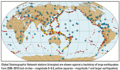
The distribution around Earth of earthquake activity varies greatly. There are places where natural earthquakes occur quite commonly, of a range of strengths from small to extremely large, because these are boundary zones between large tectonic plates. There are other places where earthquakes are infrequent and small, typically in places within the middle of the tectonic plates. Because the spatial distribution is far from uniform, each place can be described as having a characteristic degree of “seismic activity” – its individual characteristics of type, frequency and size of earthquakes that have occurred over a certain historical interval of time. More about places with high and low levels of seismic activity is presented below.
Two scales are used commonly to measure earthquake strength.
You can measure an earthquake either by its size where the rock slipped, or by the amount of shaking that is experienced at a place that interests you. Both measures are used.
The measure of the size of the earthquake where it occurred is the “magnitude.” Each earthquake has a single value on a magnitude scale – the strength right in the body of rock that sprang to a new position or broke. The magnitude scale is logarithmic – an earthquake of magnitude 2 is 30 times as large as one of magnitude 1, and an earthquake of magnitude 5 is 27,000 times larger than one of magnitude 2. A curiosity of the use of a logarithmic scale is that magnitudes of zero (0) and negative numbers are possible — that is, a negative number doesn’t imply that the energy from the earthquake is negative. For example, if you dig a hole in the ground with a shovel and break a rock at the bottom of the hole with a hammer, it will cause seismic waves to spread outward from the break; you could measure the strength of those waves on the earthquake magnitude scale, yet the magnitude value would be so small that it’s a negative number.
The information available to deduce the size – its magnitude – relies on the frequency and amplitude of seismic waves that radiate across Earth’s surface or through the rocks below ground. The first measure of earthquake magnitude that was widely used is the “Richter scale,” which depends on the amplitude of the seismic waves (the distance by which the rock wiggles or stretches when a seismic wave passes through it), adjusted for the distance from the epicenter. Over the last century, the number of recording devices (seismometers) has increased through time and the design of the seismometers has improved. Both globally and nationally there are geographically spread sets of measuring tools known as “seismic arrays” that are tuned to various frequencies. As a result, several slightly different measurements of magnitude have evolved from the original Richter scale. Because the Ithaca-area seismic array covers a small area, the unit with which magnitude is reported is the original Richter scale, in units of “ML”.
The other common earthquake measurement describes the shaking at the ground surface that results from a seismic event. This is a measure of how much the ground swayed as a wave of seismic energy passed by any particular place. Because the seismic wave itself diminishes in amplitude as it radiates through the rock – it attenuates – the intensity of shaking decreases at farther distances away from the epicenter. Several different intensity scales are used; the U.S. Geological Survey commonly uses the Modified Mercalli Intensity Scale, based on reports from people about the shaking at their location just after an earthquake occurred and on the amount of damage the earthquake caused.

Also, because the underground material at some points is strong and at other points weak, the amount of shaking differs from place to place depending on the material below the ground. For instance, a place underlain by sediments deposited in the recent geological past – some valleys are filled with this material – will shake differently than a place where strong rocks extend right to the bottom of the soil.
A distinction to keep in mind about how earthquake magnitude and earthquake intensity differ is that magnitude (such as on the Richter ML scale) is measured from specific properties of seismic waves, whereas intensity is a subjective description of an experience that changes from place to place. As a result, each earthquake has a single magnitude but a wide range of intensities.
How is an earthquake’s location determined?
The ground shaking we feel or that we measure with seismometers is the seismic wave that has traveled some unknown distance from the point where the earthquake occurred. But how do we know how far away and in which direction the earthquake occurred? To “locate” the epicenter is analogous to hearing a sound and figuring out where it came from. For example, I hear a noise and wonder, “Is it a dog barking or someone running a power tool or a baby crying? Is the cause of the sound located in the building with me, or up the street at a neighbor’s house, or in a passing car, or many blocks away?” If I walk from one place to another and continue to hear the sound, I’m more likely to learn where it comes from. Or if I ask a person who is in another room in the house where they think the noise is coming from, and compare my perception to theirs, we are likely to learn the source of the noise.
Similarly, to locate earthquakes we use data from observers or seismometers in varying places, comparing the time and nature of the seismic waves at one place to the other places – collectively, these allow the earthquake’s location to be found. In the diagram, a network of four seismometers (triangles) are located across the landscape, gathering data about the arriving seismic waves.

The map of global earthquakes shows the location of the seismometers in the global network. This map of Tompkins County’s landforms shows the locations of a local seismometer network, operated by Cornell University.
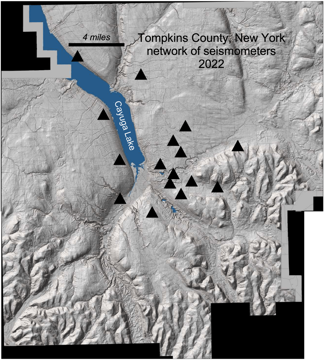
The comparison of the details of the seismic waves at multiple seismometers also allows seismologists to determine an earthquake’s depth and its magnitude. While computers evaluate the large global earthquakes, experienced scientists also examine the data and sometimes improve the estimated depth and magnitude. The need for experienced seismologists to evaluate the earthquake location, depth, and magnitude is even more vital for a very small earthquake. Therefore, if you see in the summer 2022 Tompkins County seismic reports that “microseismic event parameters will be improved through further analysis,” this statement refers to the task of identifying the source, the position, and the strength of the thing that caused the seismic wave.
Digging deeper: More about seismology and earthquakes
Earthquakes Caused by People
Earthquakes in New York State
Cornell’s seismic network

