Collecting radioactivity data of layered rocks from the borehole
There is a commonly used display of the relative radioactivity of the series of layered sedimentary rocks referred to as a “gamma log.” A gamma log is a measure of the natural radioactive decay emitted from the rocks. To acquire a gamma log, a probe is lowered down into a borehole. As the probe moves progressively past each of the rock layers, the natural radioactive emissions are recorded. The gamma profiles of thousands of old oil and gas exploration wells in New York State have been recorded. These are archived by the State.
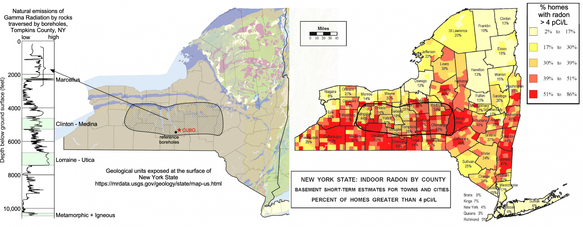
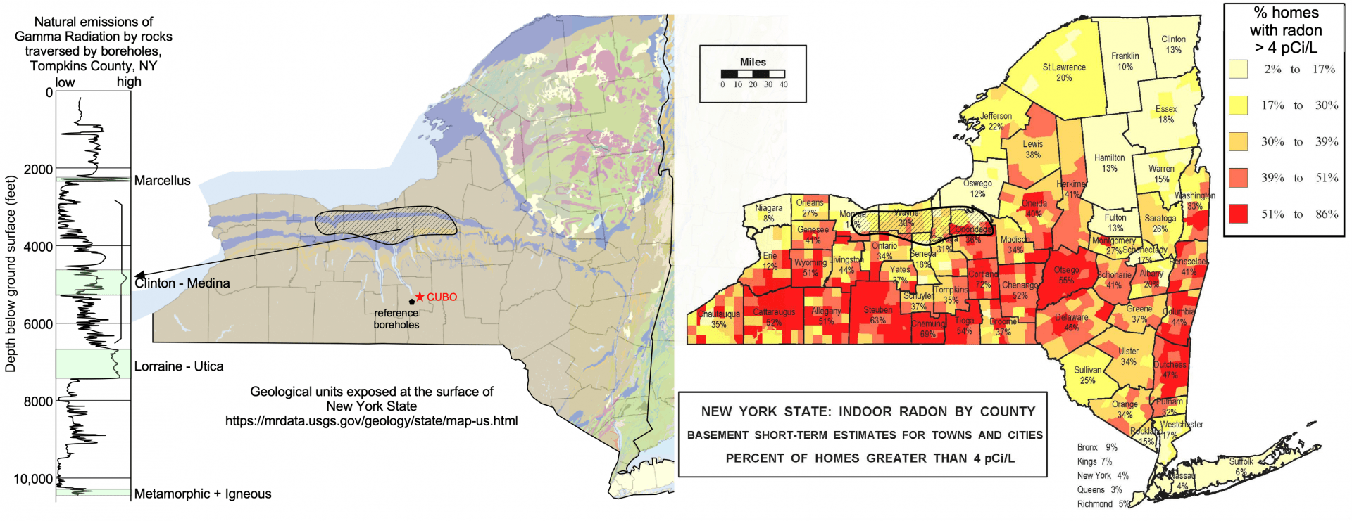
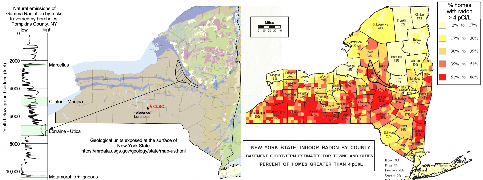
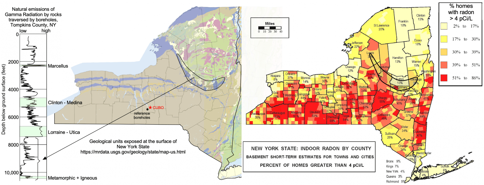
An example of a gamma log from Cayuga County is shown in the figure. You might notice that gamma counts are highest in the Marcellus shale and in the igneous or metamorphic rocks penetrated at the bottom of the borehole, where drilling stopped. Somewhat elevated gamma values are also associated with the shales above and within the Utica Formation and in the section of rock corresponding to the Clinton and Medina Groups.
This gamma log is a “worst case scenario” because it doesn’t show what part of the radiation is from uranium and thorium, which produce radon (a radioactive gas that is of concern at elevated levels), and what part is from potassium (which does not decay into radon).
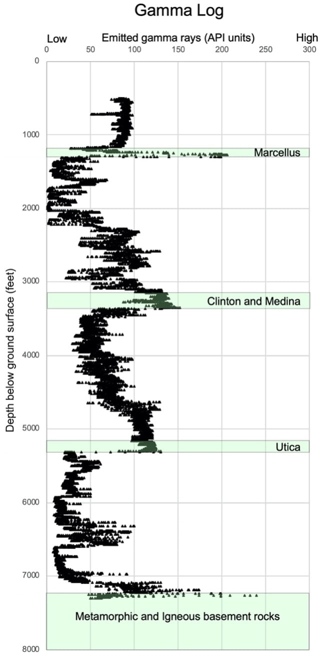
Under natural conditions, these rocks with elevated natural radioactivity are exposed at the surface at various locations in New York State. The small amounts of radioactivity that they release to the environment are the reason that homes in some regions need to mitigate radon. In the process of drilling a well, like the CUBO borehole, fragments of all the rocks will be brought to the surface via drill cuttings, which are the fragments of ground-up rock displaced as the drill bit cuts downward. Some of these cuttings will be from layers with elevated radioactivity.
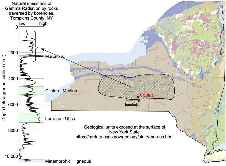
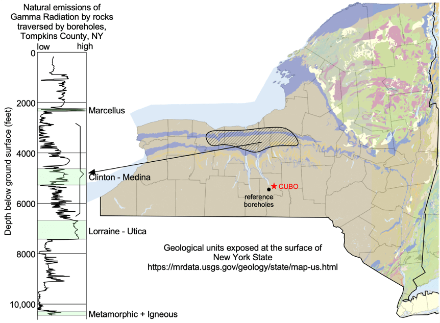
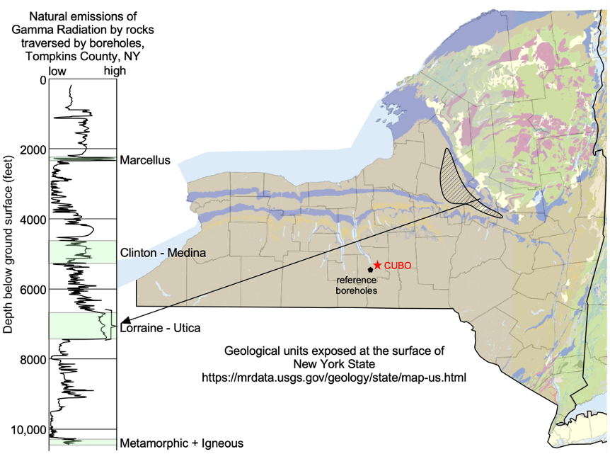
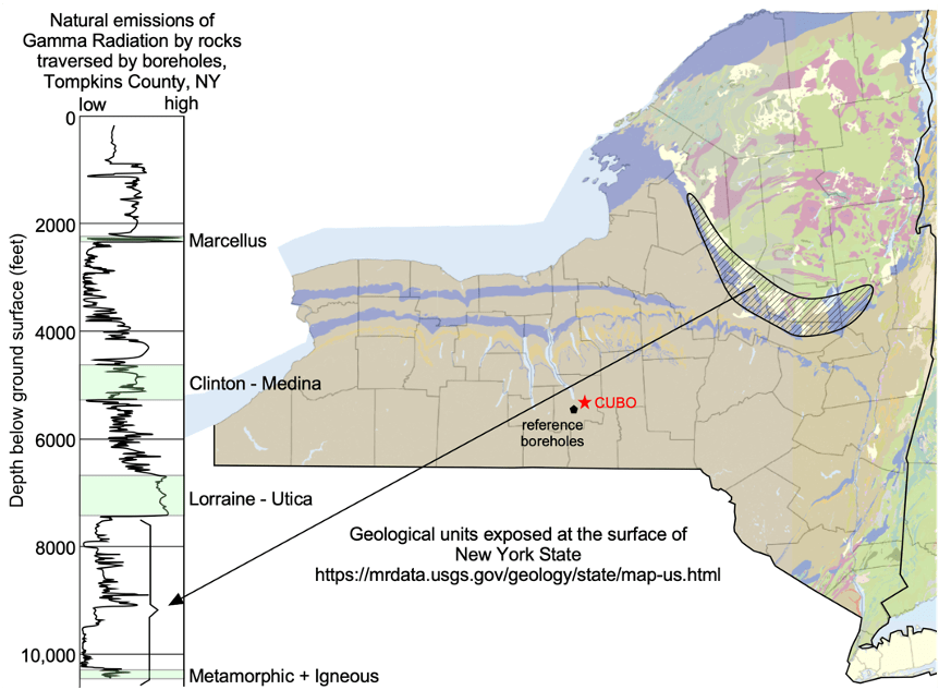
One way to think about the risk from these cuttings is to compare a typical gamma log for the Finger Lakes region, where CUBO is located, to the radon risk map and the geologic map. In Tompkins County, the surface rocks are mostly Devonian shale which, in the gamma log above and the left of the maps below, are the uppermost 1000 ft interval. These rocks have an average gamma of about 90 API, which corresponds to elevated radon in 35% of homes. The overall radiation of the full series of rocks drilled by CUBO is essentially the average of the radiation marked by the gamma emissions at all depths shown in the figure, about 60 API. This information indicates that there is probably less radiation risk from the CUBO cuttings than from the natural Tompkins County environment.
The four image pairs that follow show how zones of surface outcrops and of radon correspond to the drilling depth of the CUBO wellbore.

